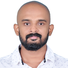
Muhammed Thouseef MT, GIS project manager

Muhammed Thouseef MT

GIS project manager

CARIFER Technologies

Location
India
Education
Master's degree, GIS
Experience
12 years, 11 Months

Share My Profile

Block User


Work Experience

Total years of experience :12 years, 11 Months

GIS project manager at CARIFER Technologies
  • Somalia - Hargeysa
  • My current job since July 2018

Manage GIS basedProperty management system project.
ArcGIS Enterprise system management.
Enterprise Geodata management.
Photogrammetry.
UAV Piloting and training.
Provide necessary training on GIS and other company products.
Understand the requirement of client and provide tilmely solutions.
Advanced GNSS survey training and survey team management.

GIS Technician at Kahrama
  • Qatar - Doha
  • March 2017 to June 2018

managing Electric and water network using ArcGIS, ArcFM Technologies

GIS System Ececutive at ESRI India Technologies LTD
  • India - Delhi
  • July 2016 to February 2017
GIS Data Quality Controller. at Geographic Technology Trading,
  • Saudi Arabia - Medina
  • March 2014 to June 2014

Checking GIS Data quality and report it, Prepare Quality assurance plan for GIS Data for Madina spatial data infrastructure

Planning Assistant - GIS at Regional Town And Country Planning Dpt
  • India - Chennai
  • December 2012 to March 2014

Designation : Planning Assistant -GIS.

Project : Preparing Master Plans (Development Plan)for Municipalities Eranakulam, Kerala.

Responsibilities:
 GIS Analysis
 Data Conversion
 Geo referencing
 Digitizing and Updating
 Development Proposals Finding
 Assists in developing geographic database structures, graphs, tables and reports.
 Data Quality checks

GIS Assistant at Town and Country Planning Office
  • India - Chennai
  • June 2009 to November 2012

Designation : GIS Assistant

Project : Integrated District Development Plan and Local Development Plan (IDDP&LDP).

Responsibilities:
 GIS Analysis
 Data Conversion
 Geo referencing
 Digitizing and Updating
 Assists in developing geographic database structures, graphs, tables and reports.
 Data Quality checks

Education

Master's degree, GIS
  • at NIIT University
  • June 2016

Geographic Information System

Master's degree, MSC Geography
  • at Madras University
  • December 2011
Diploma, Geoinformatics
  • at SEUF
  • May 2009
Bachelor's degree, BA Geography
  • at Calicat University
  • March 2008

Specialties & Skills

Photogrammetry
ArcGIS Server
Spatial Analysis
Planning and GIS Analysis
Spatial Anlysis
Arc GIS
Photogrammetry
ArcGIS Enterprise
Enterprise Geodatabase
Drone Pilot

Languages

English
Expert
Arabic
Beginner
Malayalam
Expert

Training and Certifications

Google Project Management Certificate (Certificate)
Date Attended:
June 2023
Statement of Accomplishment WITH DISTINCTION (Certificate)
Date Attended:
August 2013
Valid Until:
September 2013

Hobbies

  • Travelling, Photography, Chess.